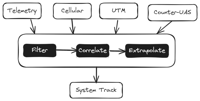
Within WP-3 of the Safir-Ready project, project partners are developing positioning data fusion technology designed to deliver reliable positioning information, with pre-defined performance characteristics (i.e., the probability of the integrity loss shall be no higher than 10e-5). Onboard GNSS data, general aviation conspicuity information, independent surveillance systems, and data from cellular networks are combined to infer and extrapolate the most accurate position. The technology features a complex algorithm developed to compare and use diverse data flows in real time.
Positioning information serves as the critical cornerstone of the U-space ecosystem. SAFIR-Med is using as many sources of information as possible to establish the most reliable positioning data, and to manage drones and their flight paths seamlessly.
The SAFIR-Ready project belongs to the SESAR 3 Joint Undertaking program and is funded by the European Commission.
For more information visit:


