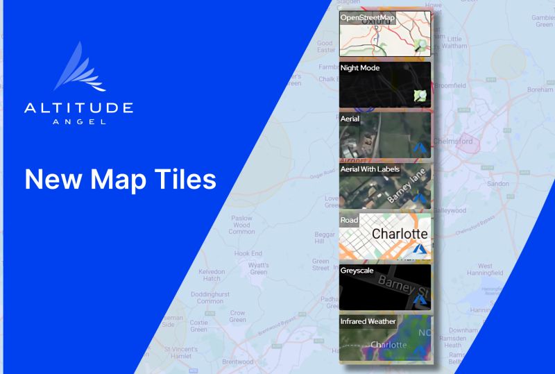
Altitude Angel’s drone flight planning and management systems have now switched to Azure Maps, Microsoft’s replacement for Bing Maps. This means there has been a change in the map tiles available, which are now: Aerial, Aerial with labels, Road (default), Grayscale, and Infrared Weather (for zone managers only).
The OpenStreetMap (OSM) options are still available, including Night Mode.
Ordnance Survey maps are no longer supported in Azure Maps but Altitude Angel is currently exploring alternatives to provide terrain and elevation data.
For more information