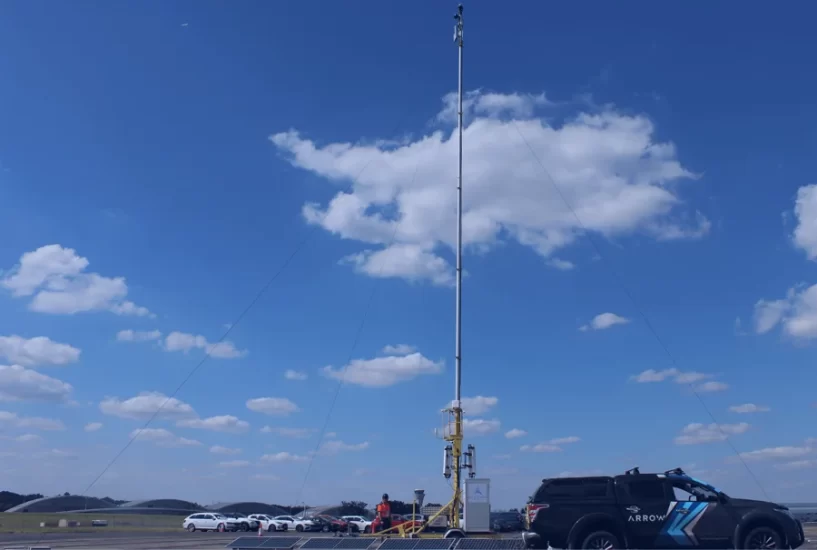
A new Detect and Avoid (DAA) platform which identifies and tracks drones and other aircraft was deployed at last week’s Farnborough International Airshow.
The Arrow ground-based DAA, deployed in partnership by NATS Services, the commercial arm of the UK’s air traffic services provider and Altitude Angel, continuously monitored the airspace, notably aircraft operating at lower levels which can be difficult to track using traditional radar systems.
Authorities at the show had real-time access to the data collected from a deployment of road-towable mast-based sensors to create a view of lower-level airspace within Farnborough Airport’s flight restricted zone (FRZ) and beyond. The infrastructure was self-sufficient, including generation of its own (solar) power and a private communications network. The result was real-time visibility of non-electronically conspicuous aircraft and drones, those which don’t carry traditional transponders, fused into a single airspace picture.
Richard Ellis, NATS Head of New Airspace Users, said: “A pop-up service like this one is a great example of how safety can be achieved in very complex environments where non-cooperative drone activity can have a real impact on an airshow.”
For more information


