

NAV CANADA has deployed the latest version of NAV DRONE, “the only RPAS app in Canada that uniquely enables drone pilots to request permission to fly their drones in civilian controlled airspace,” according to NAV CANADA’s Senior Project manager Catheleen Cziszler in a Linkedin post. “These updates bring numerous enhancements designed to improve the experience for both RPAS pilots and NAV CANADA employees,” she writes. “For RPAS pilots and operators, the new features include:
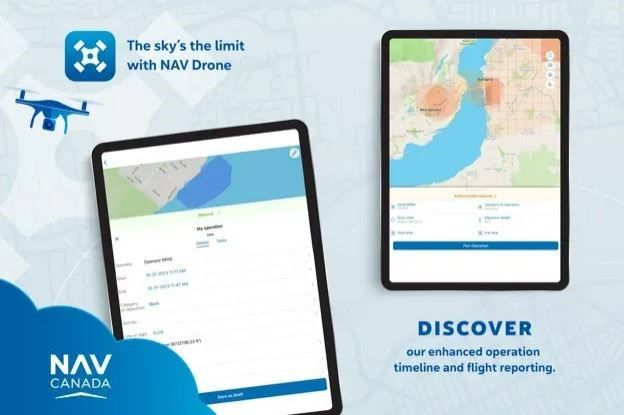
- Operation timeline: The operation details page now displays take-off and landing events in the timeline, providing a clearer overview of flight operations.
- Improved flight report: Enhancements to the flight report include a new layout and the addition of local time, offering a more user-friendly and informative experience.
- Strategic deconfliction: This feature assists RPAS pilots in planning operations by showing alternative timelines when a planned RPAS operation conflicts with other geozones, including those planned by other pilots.
- Distance calculator: RPAS operators can now measure distances when planning a new operation or on the flight map using the distance calculator feature, enhancing precision and planning capabilities.
- Adjustable flight path width: The flight path width can now be adjusted according to operational constraints, including Max Span and Surface area, allowing for more flexible and safe flight planning.
- “To ensure all new and experienced RPAS pilots and operators have the resources they need to use NAV Drone, a new series of how-to videos have also been added to our NAV DRONE support website.”
For more information
https://www.linkedin.com/feed/update/urn:li:activity:7204134088755003392/
